Day 6: We're walking, and we're walking, and we're walking...
By Matthew Pedone
October 22nd, 2014
Up and out of the room by 8:00. Quick breakfast of cereal, coffee, and a croissant (pre-packaged, but not horrible) and we're on the road. We’re not rushing, but we do have a few things we want to do today, including driving to our next hotel, a B&B in Cloverdale, at the northern end of Sonoma Valley.
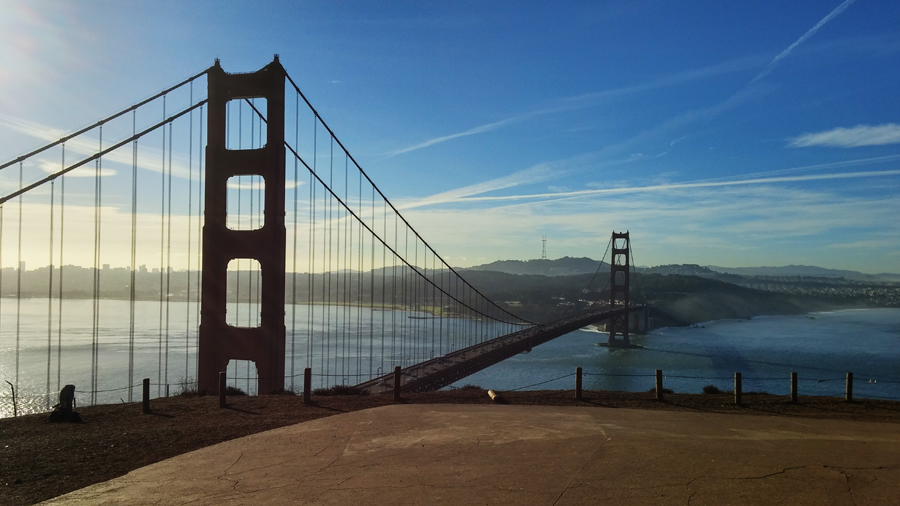
Driving across the Golden Gate Bridge is actually pretty cool. It’s just such an iconic image, that to actually be driving over it gives me a little thrill. I am sure there are people who commute into the city every day for whom this is just another part of the drive, but it’s still new to me.
There's no one at the scenic view across the bridge, so we stop and take some pictures. A tour group shows up and a friendly tourist offers to take our picture for us. Ducking away as that group milled about, we decided to drive up the large hill next to the bridge, at the top of which we parked and hiked a short trail to Battery Spencer, so named because there used to be large guns trained on the Bay here. Now, it’s just an empty bunker and a great place to get fantastic views of the bridge and the city.
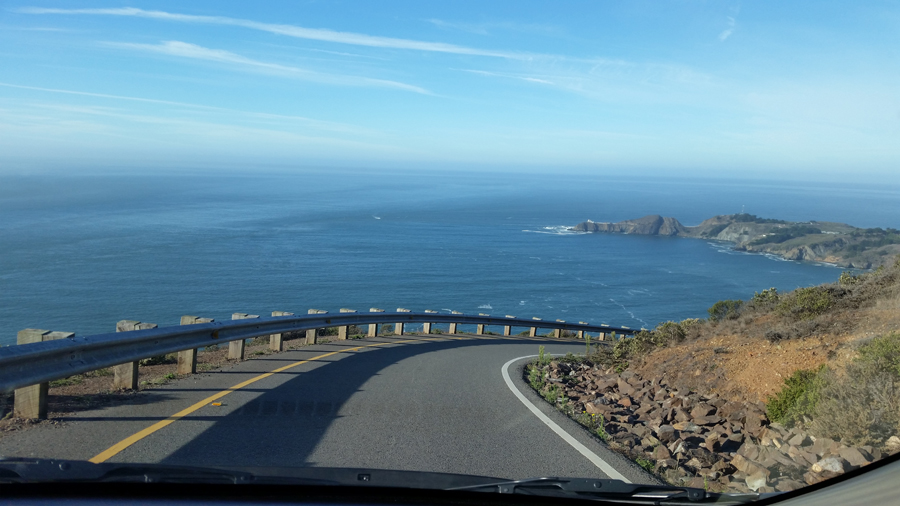
Moving on, we follow the road to an unnamed battery site and more views of the bridge and city. The site is another disused military installation, one of many in these hills, making me wonder if these hills are hills at all, or just a massive underground bunker. The site is also the top of a one-lane, one-way road, leading down to the Point Bonita lighthouse, on the water.
Our options are to either go back the way we came and circle around to get to the lighthouse, or head down this scary little road. We're not actually sure how to get there going back the way we came, so we nut up and take the road, a windy, 18% downgrade. Near the bottom of the first hill, we get out and walk up a steep hill to get some more views of the coast, then up and down the rest of the way to the visitor's center and the lighthouse (with at least one more picture stop).
We park at the head of the trail, a paved path leading further down the side of the hill to a tunnel through the hill. Now, there’s no reason the Coast Guard couldn’t have kept the path going around the hill, but I think they decided to build a short tunnel which they could use as a sort of gatehouse on the path to the lighthouse. Or, at least, that’s what it’s used for now, as the light, while still active, is a common tourist destination, and closed today.
We can’t walk all the way to the lighthouse, but we head down anyway, walking as far as we can before turning back. The path runs down along a cove of sorts, then out onto the point, a rocky bit of land jutting out into the Pacific Ocean. Someday, I’d love to come back out here when the lighthouse is open. The views from the path are beautiful; I can only imagine how much better they are from the actual point.
The walk back is nearly straight uphill, but we conquer it, and are happy to not have to do anything like that again, much like the scary/exhilarating windy mountain road, which probably means that the next thing we do will either be an even steeper hike or an even scarier drive. Well, let’s not dwell on that right now and move on to our next destination.
Back on the 101, to Route 1, which winds its way up Sausalito's hills to Muir Woods Road, which winds its way up Mt. Tamalpais (which I still am not sure how to pronounce), and then back down, with – guess what? - a terrifying road full of constant switchbacks on the side of the mountain with no guardrails. Pretty sure these roads are proof that it NEVER snows/ices up out here, because everyone would die.
I’ve driven in blizzards. In ice storms. I’ve driven in torrential downpours that were left-over from a hurricane. This is the most scared I’ve been driving a car. Not only are we driving down the side of a mountain with no guardrail to our left, to our right is the mountain, meaning the margin for error is the width of the barely-existent breakdown lane.
And, of course, while I’m inching down the hill, hands clutched white-knuckle tight on the steering wheel, full-sized shuttle busses head up the hill, cruising along as though they’re driving around a parking lot, not on the edge of a mountain with nothing to stop them from tumbling down into the ravine if they miss a corner. I might not be cut out for this.
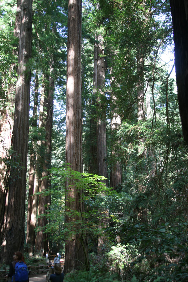
Finally, we reach the bottom, find parking and head into Muir Woods, which is beautiful. Massive redwoods and mighty oaks, and a nice boardwalk through the trees. Still, there’s something… Familiar about this place. I feel like… I don’t know, like I’m quoting the wrong movie. Many of the Endor scenes in “Return of the Jedi” were filmed here, which I did not know before coming here, but it turns out that this trip is just chock full of locations from movies I love. I think this is the last one, though (it isn't).

No Ewoks were harmed during this roadtrip. Or found. Whcih is probably fine. They're cute, but they eat humans.
The boardwalk ends about a mile into the woods. Beyond that are miles of Mt. Tamalpais State Park hiking trails, some snaking up the side of the mountain. We hike for a bit, then decide to venture up one of the mountain trails in search of scenic views. The Fern Creek Trail is pretty easy, and we decide to take the Lost Trail up to the Ocean View trail. It's only a half mile. How bad could it be? Oh, it’s a half mile STRAIGHT UP? Word of the day is "Switchback", and there were plenty. Also, plenty of stairs, which sounds good for hiking, but they are killers on the legs. At this point, I can’t believe I thought the path from the lighthouse back to the car was steep.
After 3 days of hiking, we make the Ocean View connection, have a rest, some water, and some trail mix. We then make the mature, responsible decision. No, not to head straight down, but to keep going up! There's no ocean view until you get to the next trail up, the Panoramic Highway. So, we keep going up and up and up. Alcatraz was a bump compared to this. We make it, though, and are treated to a hazy view that might be the ocean. The surrounding hills are beautiful, though, and we feel a sense of accomplishment in making it so far up.
Then, we begin the descent. The first part is nice and quick, and we're feeling good, but that’s just back to the intersection of the Lost and Ocean View trails. We consider heading back down the Lost Trail to Fern Creek, but Ocean View is more direct, and just 1.2 miles to go. Apparently, miles are longer in California, because it takes us another week and a half to get down.
Eventually, we make it back to the boardwalk, and then to the car. We calculate that we walked about four miles in total. This doesn't include the 2 miles back to the car (not really; it may come as a slight surprise, but I have been exaggerating a couple of things). We have a quick bit to eat, take some Advil, and sit in the car, catching our breath and resting our entire bodies.
As we’re convalescing, a woman approaches the window and holds her Garmin GPS out to me. “Can you help me with this?” she says. “I can’t see very well, and my husband’s Italian.” This might be one of my favorite things a stranger has said to me on any trip Sarah and I have taken. I program it to get them to the airport, then Sarah and I decide to get back on the road. Fortunately, the road we’re on has an alternate route back to 1, and though it still involves a switchback-laden road, it’s far less steep, and there are guardrails.
The 101 is bumper-to-bumper traffic most of the way through Santa Rosa, so it takes us about twice as long to get to Healdsburg as we'd expected, but does put us there right in time for dinner. We eat at the Healdsburg Bar & Grill, owned and operated by Top Chef Master Douglas Keane. Great wings, great burger, and a beer.
A quick stop at CVS, a slight detour to check out a snazzy BMW, and we were back on the 101 (with no traffic, thankfully) up to Cloverdale, and the Vintage Towers Bed & Breakfast. We're checking in late, so they leave us keys and instructions outside. Feels like another Airbnb situation, but the B&B is a beautiful old Victorian, the assistant innkeeper leaves out fresh brownies for us, and we are just happy to have a place to shower and crash, because we are exhausted.
Posted: 06.15.17


